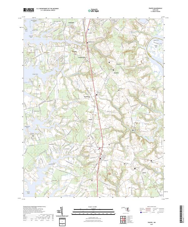
2023 Map of Trappe
USGS Topo · Published 2023About this map
Trappe and the surrounding neck lands of Talbot County define this landscape of tidal inlets and established crossroads. The region's long memory is preserved through numerous burial grounds, such as Old Whitemarsh Cem and Queen Esther Cem, reflecting the deep roots of the local community. The terrain is deeply fingered by the Choptank River, Tred Avon River, and Trippe Creek, creating distinct geographic enclaves like Baileys Neck and Edmundson Neck. These peninsulas, once critical for waterborne commerce, now host a network of local roads such as Almshouse Rd and White Marsh Rd that connect smaller settlements like Ivytown and Hambleton. This modern survey by the U.S. Geological Survey illustrates how the historical footprint of churchyards and family landings remains a structural part of the Maryland Eastern Shore landscape.
Find a feature on this map
97 named features on this map. Tap any name to fly to it.
Don’t see what you’re looking for? This feature index may not catch every label — zoom into the map to look around manually.
Map Details
Editions of this 2023 Trappe Map
This is the sole edition of this map. No revisions or reprints were ever made.
Other maps of this area

1898 · Choptank
USGS Topo · 1:125,000

1904 · St. Michaels
USGS Topo · 1:62,500

1904 · Oxford
USGS Topo · 1:62,500

1905 · Denton
USGS Topo · 1:62,500

1905 · Hurlock
USGS Topo · 1:62,500

1908 · Choptank
USGS Topo · 1:125,000

1942 · Oxford
USGS Topo · 1:31,680

1942 · Church Creek
USGS Topo · 1:24,000
1942 · Easton
USGS Topo · 1:24,000
1942 · St. Michaels
USGS Topo · 1:24,000