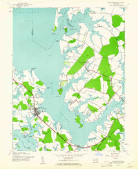
1942 Map of St. Michaels
USGS Topo · Published 1961About this map
St Michaels sits at the center of this Eastern Shore landscape, its waterfront defined by a complex network of tidal reaches and peninsulas. The 1942 topography reveals an economy still deeply tied to the water, with the Miles River, Broad Creek, and Hunting Creek carving deep into the Talbot County mainland. The arrival of the Baltimore and Eastern railroad corridor links inland points like Kirkham and Newcomb to the harbor at St Michaels, facilitating the transport of local goods. Further north, smaller rural communities such as Copperville, Tunis Mills, and Unionville are clustered near the headwaters of Leeds Creek, while Wye Island remains separated by the Wye East River. This mid-century survey illustrates the intricate relationship between the peninsula's agricultural land and the vast Chesapeake tributaries that isolate and sustain these historic settlements.
Find a feature on this map
48 named features on this map. Tap any name to fly to it.
Don’t see what you’re looking for? This feature index may not catch every label — zoom into the map to look around manually.
Map Details
Editions of this 1942 St. Michaels Map
3 editions found
Other maps of this area

1892 · Annapolis
USGS Topo · 1:62,500

1893 · Sharps Island
USGS Topo · 1:62,500

1898 · Choptank
USGS Topo · 1:125,000

1904 · St. Michaels
USGS Topo · 1:62,500

1904 · Annapolis
USGS Topo · 1:62,500

1904 · Sharps Island
USGS Topo · 1:62,500

1904 · Oxford
USGS Topo · 1:62,500

1908 · Choptank
USGS Topo · 1:125,000

1942 · Tilghman
USGS Topo · 1:31,680

1942 · Oxford
USGS Topo · 1:31,680