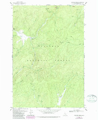
1978 Map of Trapper Creek
USGS Topo · Published 1987About this map
Nez Perce National Forest dominates this topographic survey, centered on the confluence of the Red River and the South Fork Red River. The landscape reflects a mix of remote administrative presence and early-to-mid 20th-century resource extraction, notably visible through the Dredge Tailings near the local Landing Strip. The presence of the Red River Ranger Sta and the Radio Facility highlights the area's role as a managed wilderness hub during the late 1970s.
Find a feature on this map
31 named features on this map. Tap any name to fly to it.
Don’t see what you’re looking for? This feature index may not catch every label — zoom into the map to look around manually.
Map Details
Editions of this 1978 Trapper Creek Map
2 editions found
Other maps of this area

1956 · Elk City
USGS Topo · 1:250,000

1960 · Elk City
USGS Topo · 1:250,000

1966 · Elk City
USGS Topo · 1:24,000

1966 · Black Hawk Mtn
USGS Topo · 1:24,000

1966 · Sable Hill
USGS Topo · 1:24,000

1977 · Boston Mtn
USGS Topo · 1:24,000

1978 · Moose Butte
USGS Topo · 1:24,000

1978 · Hida Point
USGS Topo · 1:24,000

1978 · Trapper Creek
USGS Topo · 1:24,000

1979 · Dixie
USGS Topo · 1:24,000