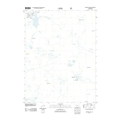
2011 Map of Trappers Lake
USGS Topo · Published 2011About this map
Trappers Lake anchors a landscape defined by its high-altitude water bodies and the headwaters of the White River system. This 2011 survey details the recreational infrastructure surrounding the lake, including Shepherds Rim Campground, Cutthroat Campground, and Bucks Campground. These sites, along with multiple access points like the Trappers Outlet Trailhead, reflect the managed use of the Flat Tops wilderness area. Beyond the main lake, the map traces the North Fork White River as it passes through the Amphitheatre and the South Fork White River further south.
Find a feature on this map
42 named features on this map. Tap any name to fly to it.
Don’t see what you’re looking for? This feature index may not catch every label — zoom into the map to look around manually.
Map Details
Editions of this 2011 Trappers Lake Map
This is the sole edition of this map. No revisions or reprints were ever made.
Other maps of this area

1927 · Glenwood Springs
USGS Topo · 1:125,000

1930 · Glenwood Springs
USGS Topo · 1:125,000

1954 · Craig
USGS Topo · 1:250,000

1957 · Craig
USGS Topo · 1:250,000

1957 · Leadville
USGS Topo · 1:250,000

1958 · Craig
USGS Topo · 1:250,000

1959 · Leadville
USGS Topo · 1:250,000

1960 · Leadville
USGS Topo · 1:250,000

1960 · Craig
USGS Topo · 1:250,000

1962 · Leadville
USGS Topo · 1:250,000