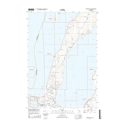
2014 Map of Traverse City SE
USGS Topo · Published 2014About this map
Traverse City anchors the southwestern edge of this survey, where the Boardman River flows into the West Arm Grand Traverse Bay. The peninsula reaching north between the bay's two arms is characterized by significant topographic relief, rising from the shoreline to the heights of Carpenter Hill. This landform creates a distinct residential pattern along the spine of Center Rd, with local landmarks like Lookout Point offering views over the water.
Find a feature on this map
103 named features on this map. Tap any name to fly to it.
Don’t see what you’re looking for? This feature index may not catch every label — zoom into the map to look around manually.
Map Details
Editions of this 2014 Traverse City SE Map
This is the sole edition of this map. No revisions or reprints were ever made.
Other maps of this area

1954 · Traverse City
USGS Topo · 1:250,000

1956 · Fife Lake
USGS Topo · 1:62,500

1956 · Kingsley
USGS Topo · 1:62,500

1957 · Traverse City
USGS Topo · 1:62,500

1957 · Elk Rapids
USGS Topo · 1:62,500

1958 · Traverse City
USGS Topo · 1:250,000

1983 · Traverse City SE
USGS Topo · 1:25,000

1983 · Traverse City
USGS Topo · 1:100,000
1983 · Elk Rapids
USGS Topo · 1:25,000
1983 · Mapleton
USGS Topo · 1:25,000