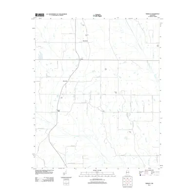
2012 Map of Trebloc
USGS Topo · Published 2012About this map
McCondy and the surrounding rural communities of Chickasaw County are documented here as they appeared in the early 21st century. The landscape is defined by a network of creeks and small family-named settlements connected by county roads. Small crossroads like Trebloc, which features a post office, and Macedonia serve as local anchors. The map reveals a dense distribution of country burial grounds that provide significant value for genealogical research, including the Thornton Cem, Macedonia Cem, and Soul Chapel Cem. To the south, the terrain follows the winding path of Houlka Creek, while other watercourses such as Chuquatonchee Creek and Johnson Bell Creek drain the surrounding fields. The settlement at Barrs Mill and the community of Una further illustrate the area's historical transition from early agricultural milling sites to a modern rural residential and farming pattern.
Find a feature on this map
58 named features on this map. Tap any name to fly to it.
Don’t see what you’re looking for? This feature index may not catch every label — zoom into the map to look around manually.
Map Details
Editions of this 2012 Trebloc Map
This is the sole edition of this map. No revisions or reprints were ever made.
Other maps of this area

1953 · West Point
USGS Topo · 1:250,000

1958 · West Point
USGS Topo · 1:250,000

1959 · West Point
USGS Topo · 1:62,500

1959 · Van Vleet
USGS Topo · 1:62,500

1959 · Pheba
USGS Topo · 1:62,500

1963 · West Point
USGS Topo · 1:250,000

1965 · Egypt
USGS Topo · 1:24,000

1966 · Prairie
USGS Topo · 1:24,000

1982 · West Point
USGS Topo · 1:100,000

1984 · West Point
USGS Topo · 1:250,000