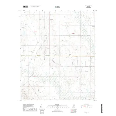
2020 Map of Trebloc
USGS Topo · Published 2020About this map
Trebloc and the surrounding rural landscapes of Chickasaw and Clay counties are defined by a network of slow-moving waterways and historic family cemeteries. The landscape is bisected by the Chickasaw Co Clay Co line, where the small communities of McCondy and Una sit amidst the drainage basins of Chuquatonchee Cr and Houlka Cr. This modern survey illustrates the persistent rural character of the region, where land divisions and roads like Clay Chickasaw Co Line Rd follow the original township and range lines of the Public Land Survey System. Genealogists will find a significant concentration of burial sites, including the Macedonia Cem, Soul Chapel Cem, and Mixon Cem, which serve as primary landmarks in this sparsely populated agricultural area. The map captures the quiet intersection of local history and topography before the meandering streams reach the larger river valleys to the south.
Find a feature on this map
66 named features on this map. Tap any name to fly to it.
Don’t see what you’re looking for? This feature index may not catch every label — zoom into the map to look around manually.
Map Details
Editions of this 2020 Trebloc Map
This is the sole edition of this map. No revisions or reprints were ever made.
Other maps of this area

1953 · West Point
USGS Topo · 1:250,000

1958 · West Point
USGS Topo · 1:250,000

1959 · West Point
USGS Topo · 1:62,500

1959 · Van Vleet
USGS Topo · 1:62,500

1959 · Pheba
USGS Topo · 1:62,500

1963 · West Point
USGS Topo · 1:250,000

1965 · Egypt
USGS Topo · 1:24,000

1966 · Prairie
USGS Topo · 1:24,000

1982 · West Point
USGS Topo · 1:100,000

1984 · West Point
USGS Topo · 1:250,000