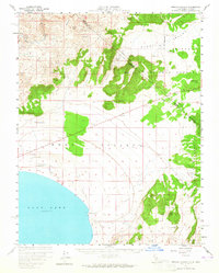
1958 Map of Trench Canyon
USGS Topo · Published 1965About this map
Brawley Peaks dominate the northwest corner of this landscape, marking a rugged high-altitude transition toward the shores of Mono Lake to the south. The 1950s terrain reveals a legacy of resource extraction and frontier transit, with the Old Railroad Grade and numerous tracks like Pole Line Road cutting through Mono Valley and Alkali Valley. Historic industrial and settlement sites are scattered throughout, including the Syndicate Mill (Site), Gray Mill, and the Toll House located near the northern springs.
Find a feature on this map
31 named features on this map. Tap any name to fly to it.
Don’t see what you’re looking for? This feature index may not catch every label — zoom into the map to look around manually.
Map Details
Editions of this 1958 Trench Canyon Map
2 editions found

Other maps of this area

1901 · Mt. Lyell
USGS Topo · 1:125,000

1909 · Hawthorne
USGS Topo · 1:250,000

1909 · Bridgeport
USGS Topo · 1:125,000

1911 · Bridgeport
USGS Topo · 1:125,000

1911 · Hawthorne
USGS Topo · 1:250,000

1914 · Mt. Morrison
USGS Topo · 1:125,000

1915 · Hawthorne
USGS Topo · 1:250,000

1920 · Bridgeport
USGS Topo · 1:125,000

1947 · Mariposa
USGS Topo · 1:250,000

1948 · Walker Lake
USGS Topo · 1:250,000