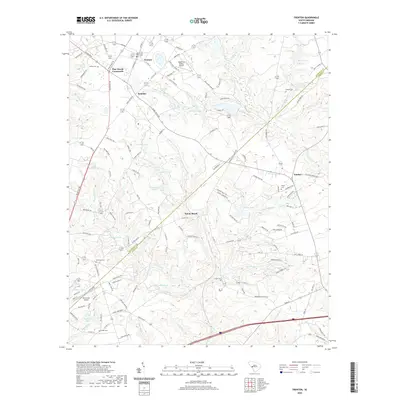
2020 Map of Trenton
USGS Topo · Published 2020About this map
Trenton serves as a central hub in this modern topographic study of the South Carolina backcountry, where the landscape transitions across the boundary of Edgefield and Aiken counties. The area is defined by a dense network of secondary roads and local routes like Augusta Rd and Edgefield Rd, connecting established settlements such as Pine House Crossroads and Sunny Brook. Aviation infrastructure is prominent with the Edgefield County Airport situated north of the Paces Branch drainage, while numerous small ponds like Mathis Pond and Harrison Pond dot the agricultural and wooded parcels.
Find a feature on this map
144 named features on this map. Tap any name to fly to it.
Don’t see what you’re looking for? This feature index may not catch every label — zoom into the map to look around manually.
Map Details
Editions of this 2020 Trenton Map
This is the sole edition of this map. No revisions or reprints were ever made.
Other maps of this area

1920 · Aiken
USGS Topo · 1:48,000

1921 · Aiken
USGS Topo · 1:62,500

1923 · Warrenville
USGS Topo · 1:48,000

1928 · Warrenville
USGS Topo · 1:62,500

1943 · Aiken
USGS Topo · 1:62,500

1943 · Warrenville
USGS Topo · 1:62,500

1954 · Augusta
USGS Topo · 1:250,000

1957 · Augusta
USGS Topo · 1:250,000

1958 · Augusta
USGS Topo · 1:250,000

1961 · Augusta
USGS Topo · 1:250,000