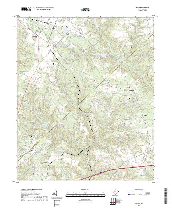
2024 Map of Trenton
USGS Topo · Published 2024About this map
Trenton sits at the northern edge of this landscape where the Edgefield Co and Aiken Co line bisects rural South Carolina. This modern survey reflects a region defined by scattered settlements and small airfields, such as the Edgefield County Airport and Twin Lakes Airport. The terrain is deeply etched by a dense network of water bodies, including Bigford Pond, Harrison Pond, and Simons Lake, which feed into the winding Shaw Creek and Paces Branch.
Find a feature on this map
125 named features on this map. Tap any name to fly to it.
Don’t see what you’re looking for? This feature index may not catch every label — zoom into the map to look around manually.
Map Details
Editions of this 2024 Trenton Map
This is the sole edition of this map. No revisions or reprints were ever made.
Other maps of this area

1920 · Aiken
USGS Topo · 1:48,000

1921 · Aiken
USGS Topo · 1:62,500

1923 · Warrenville
USGS Topo · 1:48,000

1928 · Warrenville
USGS Topo · 1:62,500

1943 · Aiken
USGS Topo · 1:62,500

1943 · Warrenville
USGS Topo · 1:62,500

1954 · Augusta
USGS Topo · 1:250,000

1957 · Augusta
USGS Topo · 1:250,000

1958 · Augusta
USGS Topo · 1:250,000

1961 · Augusta
USGS Topo · 1:250,000