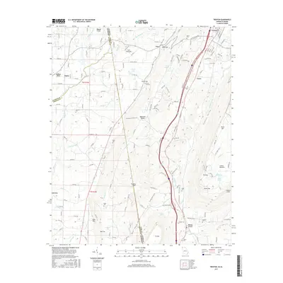
2017 Map of Trenton
USGS Topo · Published 2017About this map
Trenton sits at the northern end of Lookout Valley, where the terrain transitions between the steep escarpments of Sand Mountain and Lookout Mountain. This 2017 study illustrates the intersection of North Alabama and Northwest Georgia, highlighting how the geography of ridges and gaps has dictated local settlement and transportation. Smaller communities like Rising Fawn, Floral Crest, and Stewart Town are scattered throughout the valleys and along the mountain flanks, connected by a network of county roads and highway corridors.
Find a feature on this map
162 named features on this map. Tap any name to fly to it.
Don’t see what you’re looking for? This feature index may not catch every label — zoom into the map to look around manually.
Map Details
Editions of this 2017 Trenton Map
This is the sole edition of this map. No revisions or reprints were ever made.
Other maps of this area

1886 · Ringgold
USGS Topo · 1:125,000

1886 · Stevenson
USGS Topo · 1:125,000

1892 · Ringgold
USGS Topo · 1:125,000

1892 · Stevenson
USGS Topo · 1:125,000

1895 · Stevenson
USGS Topo · 1:125,000

1935 · Durham
USGS Topo · 1:24,000

1936 · Trenton
USGS Topo · 1:24,000

1936 · Ider
USGS Topo · 1:24,000

1936 · Shellmound
USGS Topo · 1:24,000

1936 · Bridgeport
USGS Topo · 1:24,000