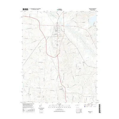
2016 Map of Trenton
USGS Topo · Published 2016About this map
Trenton serves as the central hub of this West Tennessee landscape, where the North Fork Forked Deer River meanders through the northern lowlands. The area's agricultural identity is underscored by an extensive network of rural roads named for local families and landmarks, such as Peter Smith Rd and McRee Schoolhouse Rd. To the south, the community of Fruitland sits along the transit corridor of the Old Trenton Humboldt Rd, surrounded by numerous small family cemeteries that document the area's genealogical history.
Find a feature on this map
88 named features on this map. Tap any name to fly to it.
Don’t see what you’re looking for? This feature index may not catch every label — zoom into the map to look around manually.
Map Details
Editions of this 2016 Trenton Map
This is the sole edition of this map. No revisions or reprints were ever made.
Other maps of this area

1951 · Trenton
USGS Topo · 1:24,000

1952 · Milan
USGS Topo · 1:24,000

1953 · Dyer
USGS Topo · 1:24,000

1954 · Bradford
USGS Topo · 1:24,000

1956 · Dyersburg
USGS Topo · 1:250,000

1956 · Blytheville
USGS Topo · 1:250,000

1959 · Medina
USGS Topo · 1:24,000

1959 · Blytheville
USGS Topo · 1:250,000

1959 · Humboldt
USGS Topo · 1:24,000
1964 · Alamo
USGS Topo · 1:24,000