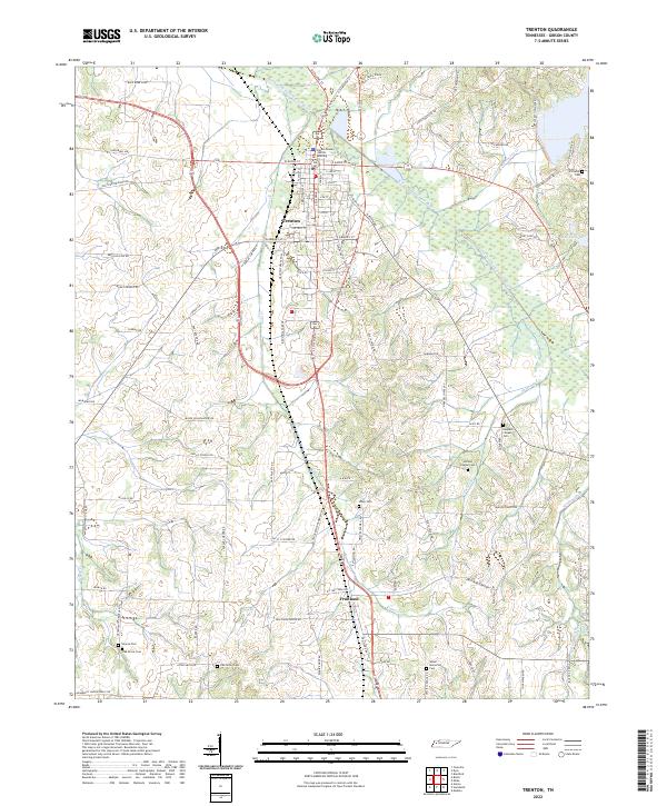
2022 Map of Trenton
USGS Topo · Published 2022About this map
Trenton serves as the seat of Gibson County, where the modern Gibson County Justice Building stands near the intersection of several historic transit corridors. The landscape is defined by the winding course of the North Fork Forked Deer River and its many tributaries, including Cain Cr and Thompson Levee Cr. Further south, the community of Fruitland anchors a network of rural roads that often bear the names of early settler families and local landmarks, such as Sally T Cooper Rd and McRee Schoolhouse Rd.
Find a feature on this map
90 named features on this map. Tap any name to fly to it.
Don’t see what you’re looking for? This feature index may not catch every label — zoom into the map to look around manually.
Map Details
Editions of this 2022 Trenton Map
This is the sole edition of this map. No revisions or reprints were ever made.
Other maps of this area

1951 · Trenton
USGS Topo · 1:24,000

1952 · Milan
USGS Topo · 1:24,000

1953 · Dyer
USGS Topo · 1:24,000

1954 · Bradford
USGS Topo · 1:24,000

1956 · Dyersburg
USGS Topo · 1:250,000

1956 · Blytheville
USGS Topo · 1:250,000

1959 · Medina
USGS Topo · 1:24,000

1959 · Blytheville
USGS Topo · 1:250,000

1959 · Humboldt
USGS Topo · 1:24,000
1964 · Alamo
USGS Topo · 1:24,000