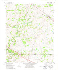
1974 Map of Trenton
USGS Topo · Published 1976About this map
The winding West Fork Red River and Red River define the agricultural landscape of the Kentucky-Tennessee border during the mid-1970s. This survey centers on the community of Trenton, a railroad town situated along the Louisville and Nashville line, which served as a vital artery for the region's rural economy. The topography is marked by small settlements like Zion and the riverside site of Barkers Mill, reflecting a settlement pattern deeply tied to water and rail access.
Find a feature on this map
25 named features on this map. Tap any name to fly to it.
Don’t see what you’re looking for? This feature index may not catch every label — zoom into the map to look around manually.
Map Details
Editions of this 1974 Trenton Map
This is the sole edition of this map. No revisions or reprints were ever made.
Other maps of this area

1944 · Clarksville
USGS Topo · 1:50,000

1950 · Guthrie
USGS Topo · 1:24,000

1950 · Pembroke
USGS Topo · 1:24,000

1951 · Pembroke
USGS Topo · 1:24,000

1951 · Elkton
USGS Topo · 1:24,000

1951 · Hopkinsville
USGS Topo · 1:24,000

1951 · New Providence
USGS Topo · 1:24,000

1951 · Hammacksville
USGS Topo · 1:24,000

1951 · Clarksville
USGS Topo · 1:24,000

1951 · Oak Grove
USGS Topo · 1:24,000