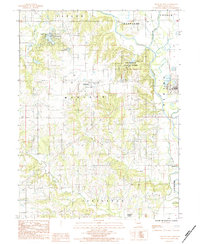
1984 Map of Trenton West
USGS Topo · Published 1984About this map
Thompson River and its meandering Old Channel Thompson River define the eastern edge of this Missouri landscape, where the city of Trenton begins its westward expansion. The terrain is a complex network of drainage basins, with the West Fork Hickory Creek and East Fork Hickory Creek converging into Hickory Creek as it flows southward toward Wolf Creek. These waterways provide a clear look at the drainage patterns that dictated early land use across the townships of Madison and Jefferson.
Find a feature on this map
26 named features on this map. Tap any name to fly to it.
Don’t see what you’re looking for? This feature index may not catch every label — zoom into the map to look around manually.
Map Details
Editions of this 1984 Trenton West Map
This is the sole edition of this map. No revisions or reprints were ever made.
Other maps of this area

1921 · Chillicothe
USGS Topo · 1:62,500

1922 · Gallatin
USGS Topo · 1:62,500

1923 · Chillicothe
USGS Topo · 1:62,500

1925 · Gilman
USGS Topo · 1:62,500

1946 · Gilman
USGS Topo · 1:48,000

1948 · Gilman
USGS Topo · 1:62,500

1948 · Trenton
USGS Topo · 1:62,500

1953 · Moberly
USGS Topo · 1:250,000

1954 · Centerville
USGS Topo · 1:250,000

1954 · Moberly
USGS Topo · 1:250,000