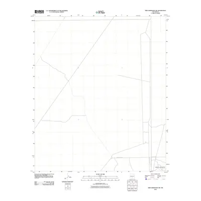
2010 Map of Tres Hermanos SW
USGS Topo · Published 2010About this map
Jarilla Mountains topography and high-desert access roads define this 2010 landscape in Otero County. This territory is largely dominated by the White Sands Missile Range, reflecting the significant military presence that has shaped land use in this part of New Mexico for decades. The restricted nature of the terrain is highlighted by specialized infrastructure like WSMR S Route 259 and WSMR S Route 252. Beyond the military boundaries, County Rd A011 serves as a primary transit corridor through the arid environment. The map provides a clear look at the intersection of public and federal lands, including various boundary markers like CS CR, which delineate the administrative divisions of this desert region.
Find a feature on this map
6 named features on this map. Tap any name to fly to it.
Don’t see what you’re looking for? This feature index may not catch every label — zoom into the map to look around manually.
Map Details
Editions of this 2010 Tres Hermanos SW Map
This is the sole edition of this map. No revisions or reprints were ever made.
Other maps of this area

1916 · Point Of Sands
USGS Topo · 1:125,000

1940 · Orogrande
USGS Topo · 1:62,500

1943 · Parker Lake
USGS Topo · 1:62,500

1943 · Orogrande
USGS Topo · 1:62,500

1947 · Orogrande North
USGS Topo · 1:24,000

1947 · Lake Lucero
USGS Topo · 1:62,500

1948 · Elephant Mountain
USGS Topo · 1:24,000
1948 · Parker Lake NE
USGS Topo · 1:24,000

1948 · Tres Hermanos
USGS Topo · 1:62,500

1948 · Lake Lucero SE
USGS Topo · 1:24,000