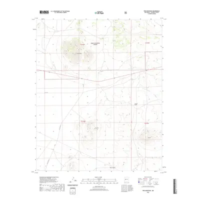
2020 Map of Tres Montosas
USGS Topo · Published 2020About this map
Tres Montosas rises as a prominent landmark within this high-elevation landscape of Socorro County, anchoring a terrain defined by deep arroyos and isolated peaks. This modern survey illustrates the expansive reach of the Cibola National Forest, where drainage systems like Arroyo Landavaso and Arroyo Montosa carve through the arid earth toward Milligan Gulch. The map records the paths of historical transit, specifically noting Old Hwy 60 and Old State Hwy 52, which trace older alignments through the brush. To the south, Gray Hill and Cat Mtn provide significant vertical relief, while the depths of Monica Canyon mark the southern boundary of the quadrangle. The sparse development emphasizes a landscape dedicated to forest management and traditional ranching routes, preserved through various Forest Service access roads like FR 10a.
Find a feature on this map
16 named features on this map. Tap any name to fly to it.
Don’t see what you’re looking for? This feature index may not catch every label — zoom into the map to look around manually.
Map Details
Editions of this 2020 Tres Montosas Map
This is the sole edition of this map. No revisions or reprints were ever made.
Other maps of this area

1954 · Tularosa
USGS Topo · 1:250,000

1954 · Socorro
USGS Topo · 1:250,000

1958 · Socorro
USGS Topo · 1:250,000

1958 · Tularosa
USGS Topo · 1:250,000

1962 · Socorro
USGS Topo · 1:250,000

1963 · Arroyo Landavaso
USGS Topo · 1:24,000

1964 · Arrowhead Well
USGS Topo · 1:24,000

1964 · Monica Saddle
USGS Topo · 1:24,000

1964 · Silver Hill
USGS Topo · 1:24,000

1964 · Tres Montosas
USGS Topo · 1:24,000