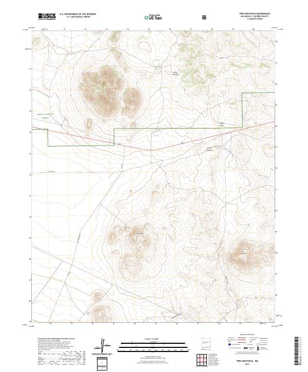
2023 Map of Tres Montosas
USGS Topo · Published 2023About this map
The high-desert terrain of Socorro County unfolds through complex drainages and volcanic rises within the Cibola National Forest. This modern survey by the U.S. Geological Survey details a landscape dominated by prominent peaks including Tres Montosas and Gray Hill, where the relief drops sharply into a network of seasonal watercourses. These natural corridors, such as Arroyo Montosa and Arroyo Landavaso, have historically dictated the movement across this arid environment. Transportation patterns are clearly etched into the topography, with contemporary forest roads intersecting former transit routes like Old State Hwy 52 and Old Hwy 60. The map illustrates the persistent intersection of modern accessibility and historical passage, tracing the same canyons and gulches like Milligan Gulch and Monica Canyon that have channeled travel through the region for generations.
Find a feature on this map
17 named features on this map. Tap any name to fly to it.
Don’t see what you’re looking for? This feature index may not catch every label — zoom into the map to look around manually.
Map Details
Editions of this 2023 Tres Montosas Map
This is the sole edition of this map. No revisions or reprints were ever made.
Other maps of this area

1954 · Tularosa
USGS Topo · 1:250,000

1954 · Socorro
USGS Topo · 1:250,000

1958 · Socorro
USGS Topo · 1:250,000

1958 · Tularosa
USGS Topo · 1:250,000

1962 · Socorro
USGS Topo · 1:250,000

1963 · Arroyo Landavaso
USGS Topo · 1:24,000

1964 · Arrowhead Well
USGS Topo · 1:24,000

1964 · Monica Saddle
USGS Topo · 1:24,000

1964 · Silver Hill
USGS Topo · 1:24,000

1964 · Tres Montosas
USGS Topo · 1:24,000