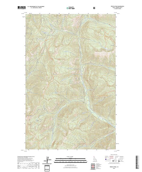
2024 Map of Trestle Peak
USGS Topo · Published 2024About this map
The Cabinet Mountains dominate this high-elevation landscape within the Kaniksu National Forest, where steep drainages and sharp ridges define the northern Idaho terrain. A legacy of resource extraction is evident at the Auxor Mine, situated near the Auxor Basin beneath the heights of Round Top Mtn. This area serves as a significant watershed, with numerous creeks such as Lightning Creek, Trestle Creek, and Quartz Creek carving deep valleys through the mountains.
Find a feature on this map
60 named features on this map. Tap any name to fly to it.
Don’t see what you’re looking for? This feature index may not catch every label — zoom into the map to look around manually.
Map Details
Editions of this 2024 Trestle Peak Map
This is the sole edition of this map. No revisions or reprints were ever made.
Other maps of this area

1911 · Priest Lake
USGS Topo · 1:250,000

1913 · Priest Lake
USGS Topo · 1:250,000

1949 · Packsaddle Mtn
USGS Topo · 1:62,500

1951 · Packsaddle Mtn
USGS Topo · 1:62,500

1951 · Clark Fork
USGS Topo · 1:62,500

1951 · Mt Pend Oreille
USGS Topo · 1:62,500

1951 · Elmira
USGS Topo · 1:62,500

1958 · Sandpoint
USGS Topo · 1:250,000

1963 · Sandpoint
USGS Topo · 1:250,000
1984 · Sandpoint
USGS Topo · 1:100,000