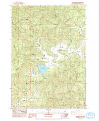
1984 Map of Triangle Lake
USGS Topo · Published 1984About this map
Triangle Lake serves as the central focal point of this western Oregon landscape, where the waters of Lake Creek and its many tributaries converge. The rural settlements of Blachly, Horton, and Post anchor the community, connected by Horton Rd and Post Road as they wind through the drainages of the Coast Range. Education and recreation are centered near the shoreline at the Triangle Lake Sch and the Blachly Lane Picnic Area.
Find a feature on this map
35 named features on this map. Tap any name to fly to it.
Don’t see what you’re looking for? This feature index may not catch every label — zoom into the map to look around manually.
Map Details
Editions of this 1984 Triangle Lake Map
This is the sole edition of this map. No revisions or reprints were ever made.
Other maps of this area

1909 · Elmira
USGS Topo · 1:62,500

1922 · Monroe
USGS Topo · 1:62,500

1922 · Elmira
USGS Topo · 1:62,500

1939 · Monroe
USGS Topo · 1:62,500

1941 · Blachly
USGS Topo · 1:62,500

1942 · Alsea
USGS Topo · 1:62,500

1942 · Elmira
USGS Topo · 1:62,500

1942 · Blachly
USGS Topo · 1:62,500

1942 · Monroe
USGS Topo · 1:62,500

1953 · Salem
USGS Topo · 1:250,000