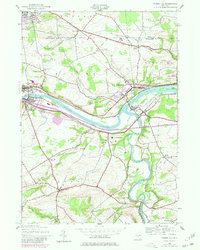
1944 Map of Tribes Hill
USGS Topo · Published 1980About this map
The Mohawk River and Erie Canal corridor define this region, where major industrial and religious sites are centered. In the 1940s, the landscape shows the convergence of the Conrail line and the Thruway, supporting the growth of Fonda and Fultonville. A significant spiritual center is evident at the Auriesville Shrine and Reparatrix Convent south of the river, while the historic Fort Johnson stands near the eastern edge. Local history is deeply embedded in the numerous family and community landmarks, including the Caughnawaga Cem and several rural schoolhouses like School No 2 and the Switzer Hill Sch. The confluence of Schoharie Creek and the Mohawk near Fort Hunter illustrates the historical importance of these waterways for early New York settlement and navigation.
Find a feature on this map
47 named features on this map. Tap any name to fly to it.
Don’t see what you’re looking for? This feature index may not catch every label — zoom into the map to look around manually.
Map Details
Editions of this 1944 Tribes Hill Map
2 editions found
Other maps of this area

1895 · Amsterdam
USGS Topo · 1:62,500

1896 · Fonda
USGS Topo · 1:62,500

1898 · Fonda
USGS Topo · 1:62,500

1899 · Broadalbin
USGS Topo · 1:62,500

1902 · Broadalbin
USGS Topo · 1:62,500

1902 · Fonda
USGS Topo · 1:62,500

1903 · Gloversville
USGS Topo · 1:62,500

1931 · Amsterdam
USGS Topo · 1:62,500

1943 · Gloversville
USGS Topo · 1:62,500
1943 · Carlisle
USGS Topo · 1:24,000