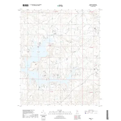
2018 Map of Trimble
USGS Topo · Published 2018About this map
Lewis Smith Lake dominates the southern reaches of this landscape, its winding fingers of water carving deep into the Cullman County hills. This 2018 survey reveals a modern rural structure where historic communities like Trimble, Loretto, and Dodge City serve as anchors for a dense network of local county roads. The complex shoreline of the lake creates a series of named points and landmarks, including Catalina Point, Speegle Point, and Goat Island, highlighting the transformation of the local terrain since the lake's creation. For genealogists and local historians, the map is particularly useful for identifying established landmarks such as the Sharon Grove Ch and numerous burial grounds like Shedd Cem, Valley Springs Cem, and Beech Grove Cem, which remain as permanent fixtures in an evolving landscape.
Find a feature on this map
158 named features on this map. Tap any name to fly to it.
Don’t see what you’re looking for? This feature index may not catch every label — zoom into the map to look around manually.
Map Details
Editions of this 2018 Trimble Map
This is the sole edition of this map. No revisions or reprints were ever made.
Other maps of this area

1888 · Cullman
USGS Topo · 1:125,000

1889 · Birmingham
USGS Topo · 1:125,000

1892 · Cullman
USGS Topo · 1:125,000

1892 · Birmingham
USGS Topo · 1:125,000

1893 · Jasper
USGS Topo · 1:125,000

1895 · Birmingham
USGS Topo · 1:125,000

1907 · Birmingham
USGS Topo · 1:125,000

1949 · Cold Springs
USGS Topo · 1:24,000

1951 · Cold Springs
USGS Topo · 1:24,000

1951 · Arkadelphia
USGS Topo · 1:24,000