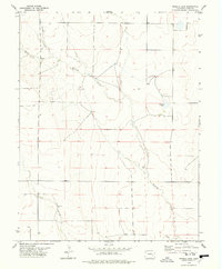
1978 Map of Trimble Lake
USGS Topo · Published 1978About this map
Mustang Creek winds across this section of the Colorado high plains, defining a landscape shaped by intermittent water and wide-open rangeland. The 1978 survey reveals a terrain marked by natural drainage features like the North Fork and South Fork, which converge as they move through the quadrangle. In an area where permanent water is scarce, Trimble Lake and scattered Well sites serve as critical landmarks for local ranching operations. The presence of Sand Arroyo in the southern portion of the sheet highlights the ephemeral nature of the local hydrology, where dry beds only flow during significant weather events. This map captures the region's character as a sparsely populated agricultural expanse, where section lines and section fences dictate the human footprint over the natural prairie.
Find a feature on this map
8 named features on this map. Tap any name to fly to it.
Don’t see what you’re looking for? This feature index may not catch every label — zoom into the map to look around manually.
Map Details
Editions of this 1978 Trimble Lake Map
This is the sole edition of this map. No revisions or reprints were ever made.
Other maps of this area

1889 · Sanborn
USGS Topo · 1:125,000

1891 · Sanborn
USGS Topo · 1:125,000

1891 · Catlin
USGS Topo · 1:125,000

1891 · Arroyo
USGS Topo · 1:125,000

1891 · Las Animas
USGS Topo · 1:125,000

1893 · Arroyo
USGS Topo · 1:125,000

1893 · Sanborn
USGS Topo · 1:125,000

1893 · Las Animas
USGS Topo · 1:125,000

1893 · Catlin
USGS Topo · 1:125,000

1954 · Lamar
USGS Topo · 1:250,000