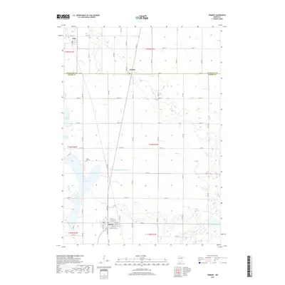
2019 Map of Trimont
USGS Topo · Published 2019About this map
Trimont anchors the southern portion of this landscape at the intersection of Co Hwy 44 and Co Hwy 38, its grid defined by streets such as Beech St E and Chestnut St E. Northward, the village of Ormsby straddles the line between Watonwan Co and Martin Co, while Odin sits at the northwestern edge. The terrain is defined by a dense network of drainage and water bodies, including Cedar Lake, Buffalo Lake, and North Lake.
Find a feature on this map
41 named features on this map. Tap any name to fly to it.
Don’t see what you’re looking for? This feature index may not catch every label — zoom into the map to look around manually.
Map Details
Editions of this 2019 Trimont Map
This is the sole edition of this map. No revisions or reprints were ever made.
Other maps of this area

1954 · Fairmont
USGS Topo · 1:250,000

1958 · Fairmont
USGS Topo · 1:250,000

1970 · St James SE
USGS Topo · 1:24,000
1970 · Butterfield
USGS Topo · 1:24,000
1970 · St James West
USGS Topo · 1:24,000

1970 · Trimont
USGS Topo · 1:24,000

1970 · Mountain Lake SE
USGS Topo · 1:24,000
1970 · St James East
USGS Topo · 1:24,000

1970 · Welcome
USGS Topo · 1:24,000

1970 · Sherburn
USGS Topo · 1:24,000