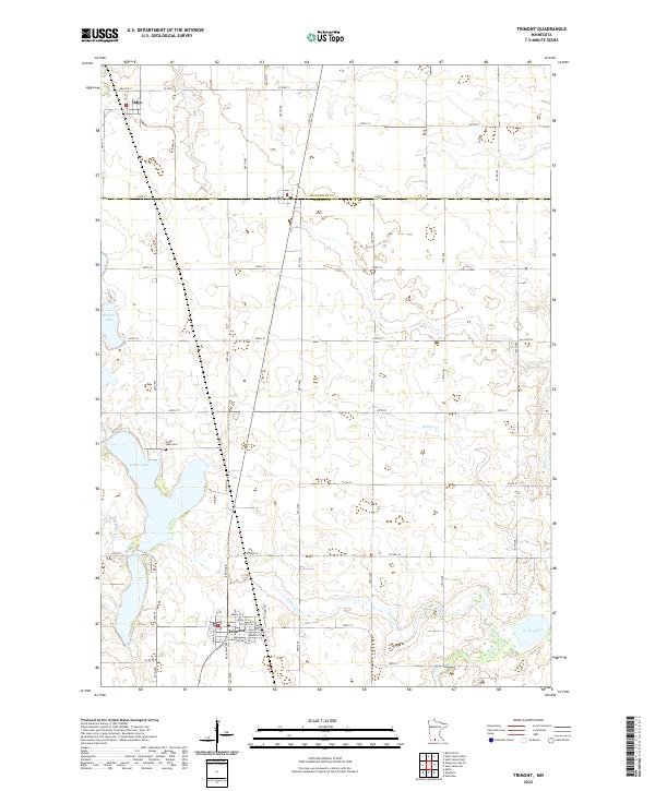
2022 Map of Trimont
USGS Topo · Published 2022About this map
Trimont serves as a central hub in this agricultural landscape of southern Minnesota, where the grid of sections and rural roads defines the movement of life. The survey highlights the transition between Martin and Watonwan counties, with the town of Ormsby straddling the line. Waterways and glacial lakes provide the primary natural variation in the terrain, most notably Cedar Lake and the smaller Buffalo Lake to the west. Genealogists will find particular value in the location of the Cedar Lake Cem positioned near the lake's northern shore. The drainage patterns of the region are clearly marked by Cedar Cr and Willow Cr, which snake through the townships of t104n r32w and t105n r32w. These water bodies and drainage systems were historically vital for the early drainage projects that converted this prairie into highly productive farmland.
Find a feature on this map
55 named features on this map. Tap any name to fly to it.
Don’t see what you’re looking for? This feature index may not catch every label — zoom into the map to look around manually.
Map Details
Editions of this 2022 Trimont Map
This is the sole edition of this map. No revisions or reprints were ever made.
Other maps of this area

1954 · Fairmont
USGS Topo · 1:250,000

1958 · Fairmont
USGS Topo · 1:250,000

1970 · St James SE
USGS Topo · 1:24,000
1970 · Butterfield
USGS Topo · 1:24,000
1970 · St James West
USGS Topo · 1:24,000

1970 · Trimont
USGS Topo · 1:24,000

1970 · Mountain Lake SE
USGS Topo · 1:24,000
1970 · St James East
USGS Topo · 1:24,000

1970 · Welcome
USGS Topo · 1:24,000

1970 · Sherburn
USGS Topo · 1:24,000