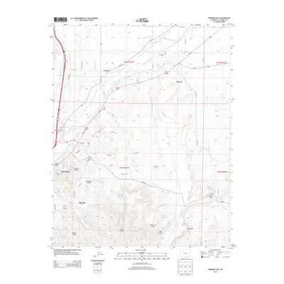
2013 Map of Trinidad East
USGS Topo · Published 2013About this map
The Purgatoire River winds through the northern half of this terrain, supporting an intricate network of irrigation including the Model Intake Canal, Pickerwire Ditch, and Chilli Ditch. In the early 21st century, this area east of Trinidad shows a landscape defined by the transition from the city's residential streets, such as East Main Street, to the rugged canyon lands of the south. The settlement of Engleville sits at the mouth of Engleville Canyon, while the smaller community of El Moro occupies the river valley to the north.
Find a feature on this map
61 named features on this map. Tap any name to fly to it.
Don’t see what you’re looking for? This feature index may not catch every label — zoom into the map to look around manually.
Map Details
Editions of this 2013 Trinidad East Map
This is the sole edition of this map. No revisions or reprints were ever made.
Other maps of this area

1891 · Spanish Peaks
USGS Topo · 1:125,000

1892 · Elmoro
USGS Topo · 1:125,000

1893 · Spanish Peaks
USGS Topo · 1:125,000

1893 · Elmoro
USGS Topo · 1:125,000

1895 · Spanish Peaks
USGS Topo · 1:125,000

1897 · Elmoro
USGS Topo · 1:125,000

1897 · Spanish Peaks
USGS Topo · 1:125,000

1900 · Spanish Peaks
USGS Topo · 1:125,000

1951 · Trinidad
USGS Topo · 1:24,000
1951 · Starkville
USGS Topo · 1:24,000