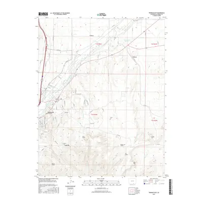
2016 Map of Trinidad East
USGS Topo · Published 2016About this map
The Purgatoire River valley and its complex irrigation network dominate this 2016 survey of the high plains east of Trinidad. A series of historic ditches, including the Johns Ditch, Chili Ditch, and S Side Ditch, illustrate a landscape long-defined by water rights and agricultural engineering. The settlement pattern shows the modern expansion of residential streets named for Old West figures like Bat Masterson Dr and Wyatt Earp St, contrasting with older rural clusters and historic burial sites such as Rivera Cem and Valdez Cem.
Find a feature on this map
82 named features on this map. Tap any name to fly to it.
Don’t see what you’re looking for? This feature index may not catch every label — zoom into the map to look around manually.
Map Details
Editions of this 2016 Trinidad East Map
This is the sole edition of this map. No revisions or reprints were ever made.
Other maps of this area

1891 · Spanish Peaks
USGS Topo · 1:125,000

1892 · Elmoro
USGS Topo · 1:125,000

1893 · Spanish Peaks
USGS Topo · 1:125,000

1893 · Elmoro
USGS Topo · 1:125,000

1895 · Spanish Peaks
USGS Topo · 1:125,000

1897 · Elmoro
USGS Topo · 1:125,000

1897 · Spanish Peaks
USGS Topo · 1:125,000

1900 · Spanish Peaks
USGS Topo · 1:125,000

1951 · Trinidad
USGS Topo · 1:24,000
1951 · Starkville
USGS Topo · 1:24,000