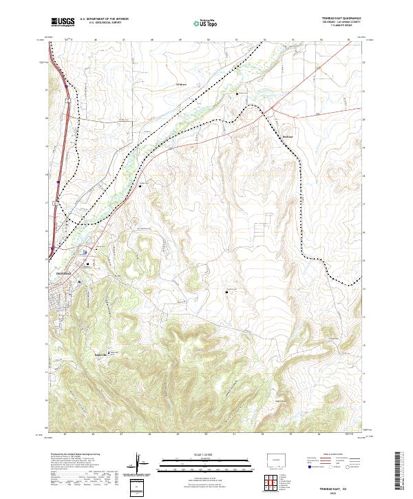
2022 Map of Trinidad East
USGS Topo · Published 2022About this map
Trinidad anchors the western edge of this landscape, where the Purgatoire River carves a wide valley through the high desert. The area's complex settlement history is visible in the numerous small burial grounds that dot the terrain, including the Trinidad Catholic Cem, Rivera Cem, and Valdez Cem. The outskirts are marked by historic mining and ranching hubs like Engleville and Beshoar, connected by a network of drainage-following roads and irrigation projects like the Model Intake Canal and Picketwire Ditch.
Find a feature on this map
81 named features on this map. Tap any name to fly to it.
Don’t see what you’re looking for? This feature index may not catch every label — zoom into the map to look around manually.
Map Details
Editions of this 2022 Trinidad East Map
This is the sole edition of this map. No revisions or reprints were ever made.
Other maps of this area

1891 · Spanish Peaks
USGS Topo · 1:125,000

1892 · Elmoro
USGS Topo · 1:125,000

1893 · Spanish Peaks
USGS Topo · 1:125,000

1893 · Elmoro
USGS Topo · 1:125,000

1895 · Spanish Peaks
USGS Topo · 1:125,000

1897 · Elmoro
USGS Topo · 1:125,000

1897 · Spanish Peaks
USGS Topo · 1:125,000

1900 · Spanish Peaks
USGS Topo · 1:125,000

1951 · Trinidad
USGS Topo · 1:24,000
1951 · Starkville
USGS Topo · 1:24,000