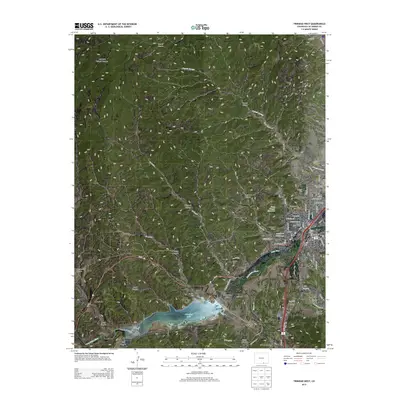
2013 Map of Trinidad West
USGS Topo · Published 2013About this map
Trinidad and its western outskirts are anchored by the winding Purgatoire River as it flows into Trinidad Lake. This landscape, dominated by the high-desert transition to the Colorado Rockies, reveals a history of settlement along the river valley and the Santa Fe Trl. The map details the institutional and community footprints of the area, from the campus of Trinidad State Jr Coll to the Las Animas County Fairgrounds. To the west, the smaller communities of Cokedale, Jansen, and Starkville follow the rail and road corridors, while numerous family and fraternal burial grounds like the Masonic Cem, Vigil Cem, and Carpios Cem offer points of interest for genealogists. Notable topographic landmarks such as Simpsons Rest and Prospect Point overlook the city, while the canyons of the Picketwire Valley provide a glimpse into the diverse terrain of Trinidad State Park.
Find a feature on this map
64 named features on this map. Tap any name to fly to it.
Don’t see what you’re looking for? This feature index may not catch every label — zoom into the map to look around manually.
Map Details
Editions of this 2013 Trinidad West Map
This is the sole edition of this map. No revisions or reprints were ever made.
Other maps of this area

1891 · Spanish Peaks
USGS Topo · 1:125,000

1892 · Elmoro
USGS Topo · 1:125,000

1893 · Spanish Peaks
USGS Topo · 1:125,000

1893 · Elmoro
USGS Topo · 1:125,000

1895 · Spanish Peaks
USGS Topo · 1:125,000

1897 · Elmoro
USGS Topo · 1:125,000

1897 · Spanish Peaks
USGS Topo · 1:125,000

1900 · Spanish Peaks
USGS Topo · 1:125,000

1951 · Trinidad
USGS Topo · 1:24,000

1951 · Valdez
USGS Topo · 1:24,000