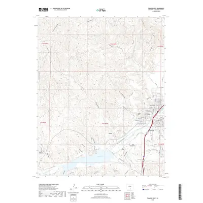
2019 Map of Trinidad West
USGS Topo · Published 2019About this map
Trinidad serves as the focal point of this survey, where the urban grid meets the complex topography of the Picketwire Valley. The map details the transition from the city’s residential streets, such as W Colorado Ave and Atchison Ave, to the sprawling waters of Trinidad Lake and its surrounding canyons. This era shows a community rooted in its institutional identity, featuring the Trinidad State Junior College and the Las Animas County Courthouse.
Find a feature on this map
91 named features on this map. Tap any name to fly to it.
Don’t see what you’re looking for? This feature index may not catch every label — zoom into the map to look around manually.
Map Details
Editions of this 2019 Trinidad West Map
This is the sole edition of this map. No revisions or reprints were ever made.
Other maps of this area

1891 · Spanish Peaks
USGS Topo · 1:125,000

1892 · Elmoro
USGS Topo · 1:125,000

1893 · Spanish Peaks
USGS Topo · 1:125,000

1893 · Elmoro
USGS Topo · 1:125,000

1895 · Spanish Peaks
USGS Topo · 1:125,000

1897 · Elmoro
USGS Topo · 1:125,000

1897 · Spanish Peaks
USGS Topo · 1:125,000

1900 · Spanish Peaks
USGS Topo · 1:125,000

1951 · Trinidad
USGS Topo · 1:24,000

1951 · Valdez
USGS Topo · 1:24,000