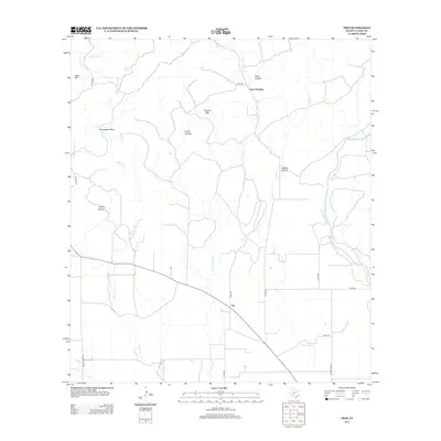
2013 Map of Trio
USGS Topo · Published 2013About this map
Trio serves as the central hub of this Uvalde County landscape, where the road network converges amidst a series of deep drainages and limestone uplands. The drainage pattern is dominated by the Blanco Cr and Little Blanco Cr systems, which cut southward toward their confluence. Notable topographic landmarks such as Ringtail Mtn and Sinks Hill define the horizon, while the eastern edge of the quadrangle captures the winding course of the Sabinal River.
Find a feature on this map
26 named features on this map. Tap any name to fly to it.
Don’t see what you’re looking for? This feature index may not catch every label — zoom into the map to look around manually.
Map Details
Editions of this 2013 Trio Map
This is the sole edition of this map. No revisions or reprints were ever made.
Other maps of this area

1898 · Uvalde
USGS Topo · 1:125,000

1899 · Uvalde
USGS Topo · 1:125,000

1954 · San Antonio
USGS Topo · 1:250,000

1956 · Sabinal
USGS Topo · 1:62,500

1956 · Tarpley
USGS Topo · 1:62,500

1956 · Utopia
USGS Topo · 1:62,500

1957 · San Antonio
USGS Topo · 1:250,000

1960 · Concan
USGS Topo · 1:24,000

1960 · Magers Crossing
USGS Topo · 1:24,000

1969 · Comanche Waterhole
USGS Topo · 1:24,000