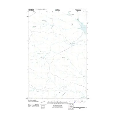
2011 Map of Triple Crossing Reservoir West
USGS Topo · Published 2011About this map
The Etchart Stone House stands as a notable landmark in this eastern Montana landscape, situated near the winding course of Willow Creek. The terrain is defined by an intricate network of water management features, including several creatively named structures like Tin Roof Dam, Sheep Shed Dam, and Winkum Dam. These small-scale reservoirs and dams illustrate the importance of water retention for ranching in Valley County, where seasonal drainages such as Middle Fork Lone Tree Creek and Hard Pan Creek shape the distribution of resources. The map captures a high density of named coulees and reservoirs, such as Triple Crossing Reservoir and Halfpint Reservoir, which serve as critical nodes in an otherwise expansive and sparsely settled rangeland. The infrastructure is connected by rural routes like Stonehouse Rd and the Triple Cross Access Rd, which facilitate movement between these remote water sources and homesteads.
Find a feature on this map
32 named features on this map. Tap any name to fly to it.
Don’t see what you’re looking for? This feature index may not catch every label — zoom into the map to look around manually.
Map Details
Editions of this 2011 Triple Crossing Reservoir West Map
This is the sole edition of this map. No revisions or reprints were ever made.
Other maps of this area

1954 · Jordan
USGS Topo · 1:250,000

1954 · Glasgow
USGS Topo · 1:250,000

1956 · Jordan
USGS Topo · 1:250,000

1957 · Glasgow
USGS Topo · 1:250,000

1958 · Glasgow
USGS Topo · 1:250,000

1958 · Jordan
USGS Topo · 1:250,000

1964 · Jordan
USGS Topo · 1:250,000
1973 · Triple Crossing Reservoir East
USGS Topo · 1:24,000

1973 · Triple Crossing Reservoir West
USGS Topo · 1:24,000

1973 · Niles Coulee
USGS Topo · 1:24,000