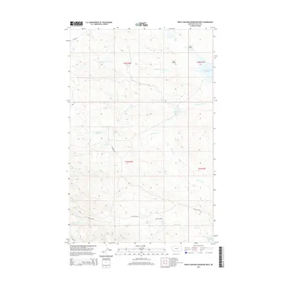
2014 Map of Triple Crossing Reservoir West
USGS Topo · Published 2014About this map
Triple Crossing Reservoir serves as a central landmark in this portion of the Montana-Valley County borderlands, where the landscape is defined by an intricate network of intermittent drainages and coulees. Water management in this arid grazing country is evidenced by several named catchments, including the ULT Reservoir, Finn Reservoir, and the descriptively named Ruins Reservoir. These features, along with Halfpint Reservoir at the southern edge, illustrate the vital role of livestock watering holes in the region's ranching economy.
Find a feature on this map
20 named features on this map. Tap any name to fly to it.
Don’t see what you’re looking for? This feature index may not catch every label — zoom into the map to look around manually.
Map Details
Editions of this 2014 Triple Crossing Reservoir West Map
This is the sole edition of this map. No revisions or reprints were ever made.
Other maps of this area

1954 · Jordan
USGS Topo · 1:250,000

1954 · Glasgow
USGS Topo · 1:250,000

1956 · Jordan
USGS Topo · 1:250,000

1957 · Glasgow
USGS Topo · 1:250,000

1958 · Glasgow
USGS Topo · 1:250,000

1958 · Jordan
USGS Topo · 1:250,000

1964 · Jordan
USGS Topo · 1:250,000
1973 · Triple Crossing Reservoir East
USGS Topo · 1:24,000

1973 · Triple Crossing Reservoir West
USGS Topo · 1:24,000

1973 · Niles Coulee
USGS Topo · 1:24,000