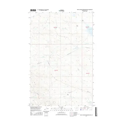
2017 Map of Triple Crossing Reservoir West
USGS Topo · Published 2017About this map
Triple Crossing Reservoir and its surrounding watershed define this portion of Valley County, characterized by a complex network of ephemeral drainages and constructed water catchments. The landscape is carved by deep seasonal channels such as Middle Fork Lone Tree Cr and Tony Coulee, reflecting a terrain managed for livestock and resource conservation. Scattered throughout the territory are several named catchments, including Finn Reservoir, Ult Reservoir, and the suggestively named Ruins Reservoir, which indicate a long history of water management in this arid stretch of Montana. Transportation through the area is restricted to isolated corridors like Ridge Rd and the Triple Cross Access Rd, which serve the high ground between the S Fork Willow Cr and the northern coulees.
Find a feature on this map
22 named features on this map. Tap any name to fly to it.
Don’t see what you’re looking for? This feature index may not catch every label — zoom into the map to look around manually.
Map Details
Editions of this 2017 Triple Crossing Reservoir West Map
This is the sole edition of this map. No revisions or reprints were ever made.
Other maps of this area

1954 · Jordan
USGS Topo · 1:250,000

1954 · Glasgow
USGS Topo · 1:250,000

1956 · Jordan
USGS Topo · 1:250,000

1957 · Glasgow
USGS Topo · 1:250,000

1958 · Glasgow
USGS Topo · 1:250,000

1958 · Jordan
USGS Topo · 1:250,000

1964 · Jordan
USGS Topo · 1:250,000
1973 · Triple Crossing Reservoir East
USGS Topo · 1:24,000

1973 · Triple Crossing Reservoir West
USGS Topo · 1:24,000

1973 · Niles Coulee
USGS Topo · 1:24,000