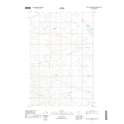
2020 Map of Triple Crossing Reservoir West
USGS Topo · Published 2020About this map
Triple Crossing Reservoir serves as a primary water source in this corner of Valley County, Montana, where a network of coulees and creeks drains the landscape. The hydrology of the region is defined by the branching systems of Middle Fork Lone Tree Cr and S Fork Lone Tree Cr, along with the S Fork Willow Cr to the south. Small-scale water management is evident through numerous specialized catchments including the Ruins Reservoir, Finn Reservoir, and the diminutive Halfpint Reservoir. Remote access to these drainage basins is maintained by the Triple Cross Access Rd and Stonehouse Rd. The land is characterized by sharp relief features such as Tony Coulee and Short Coulee, which represent the transition from the high prairie into the intricate creek beds that feed the Missouri River watershed.
Find a feature on this map
22 named features on this map. Tap any name to fly to it.
Don’t see what you’re looking for? This feature index may not catch every label — zoom into the map to look around manually.
Map Details
Editions of this 2020 Triple Crossing Reservoir West Map
This is the sole edition of this map. No revisions or reprints were ever made.
Other maps of this area

1954 · Jordan
USGS Topo · 1:250,000

1954 · Glasgow
USGS Topo · 1:250,000

1956 · Jordan
USGS Topo · 1:250,000

1957 · Glasgow
USGS Topo · 1:250,000

1958 · Glasgow
USGS Topo · 1:250,000

1958 · Jordan
USGS Topo · 1:250,000

1964 · Jordan
USGS Topo · 1:250,000
1973 · Triple Crossing Reservoir East
USGS Topo · 1:24,000

1973 · Triple Crossing Reservoir West
USGS Topo · 1:24,000

1973 · Niles Coulee
USGS Topo · 1:24,000