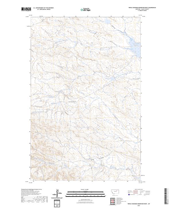
2024 Map of Triple Crossing Reservoir West
USGS Topo · Published 2024About this map
Middle Fork Lone Tree Creek and its southern counterpart, the South Fork Lone Tree Creek, define the drainage patterns of this Valley County landscape. The area is characterized by a series of high-prairie reservoirs, including the Ruins Reservoir and Finn Reservoir, which suggest the critical importance of water management for livestock and agriculture in this semi-arid region. These artificial water bodies are connected by a sparse network of gravel roads such as Stonehouse Rd and the Triple Cross Access Rd. The topographic detail reveals a complex system of coulees, notably Long Coulee and Tony Coulee, which channel seasonal runoff toward larger systems like Willow Creek. This 2024 U.S. Geological Survey data provides a contemporary look at the rural infrastructure of the Montana plains, where named landmarks often center on these essential water sources and the grazing lands they support.
Find a feature on this map
20 named features on this map. Tap any name to fly to it.
Don’t see what you’re looking for? This feature index may not catch every label — zoom into the map to look around manually.
Map Details
Editions of this 2024 Triple Crossing Reservoir West Map
This is the sole edition of this map. No revisions or reprints were ever made.
Other maps of this area

1954 · Jordan
USGS Topo · 1:250,000

1954 · Glasgow
USGS Topo · 1:250,000

1956 · Jordan
USGS Topo · 1:250,000

1957 · Glasgow
USGS Topo · 1:250,000

1958 · Glasgow
USGS Topo · 1:250,000

1958 · Jordan
USGS Topo · 1:250,000

1964 · Jordan
USGS Topo · 1:250,000
1973 · Triple Crossing Reservoir East
USGS Topo · 1:24,000

1973 · Triple Crossing Reservoir West
USGS Topo · 1:24,000

1973 · Niles Coulee
USGS Topo · 1:24,000