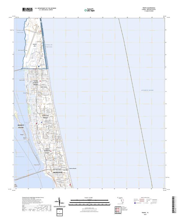
2024 Map of Tropic
USGS Topo · Published 2024About this map
Patrick Air Force Base and the newly designated Patrick Space Force Base dominate the northern portion of this coastal barrier island, illustrating the region's enduring importance to national defense and aerospace operations. The landscape is a complex network of residential coastal communities and intricate waterways, where the Grand Canal and Banana River separate the mainland from the narrow strip of land containing Satellite Beach and Indian Harbour Beach.
Find a feature on this map
99 named features on this map. Tap any name to fly to it.
Don’t see what you’re looking for? This feature index may not catch every label — zoom into the map to look around manually.
Map Details
Editions of this 2024 Tropic Map
This is the sole edition of this map. No revisions or reprints were ever made.
Other maps of this area

1949 · Melbourne West
USGS Topo · 1:24,000

1949 · Melbourne East
USGS Topo · 1:24,000

1949 · Eau Gallie
USGS Topo · 1:24,000

1949 · Cocoa
USGS Topo · 1:24,000

1949 · Cocoa Beach
USGS Topo · 1:24,000

1949 · Tropic
USGS Topo · 1:24,000

1951 · Melbourne East
USGS Topo · 1:24,000

1951 · Eau Gallie
USGS Topo · 1:24,000

1951 · Cocoa
USGS Topo · 1:24,000

1951 · Melbourne West
USGS Topo · 1:24,000