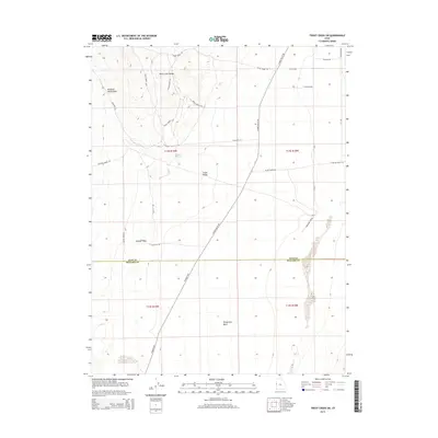
2014 Map of Trout Creek SW
USGS Topo · Published 2014About this map
Snake Valley serves as the dominant geographical feature of this high-desert landscape on the border of Millard and Juab counties. The terrain transitions from the alluvial fans and ephemeral drainages of the Deep Creek Range in the northwest to the flat basin floor. Water sources are scarce, marked by the presence of Coyote Spring and seasonal channels like Sulphur Wash and Tungstonia Wash. The map documents a sparse but deliberate network of ranching and access roads, including the evocatively named Crazy Horse Maze and several branches of Black Horse Rd. This 2014 survey records a remote segment of the Great Basin where the N Gandy Hwy provides the primary north-south transit, tracing the base of the mountains through land divided into large township sections.
Find a feature on this map
27 named features on this map. Tap any name to fly to it.
Don’t see what you’re looking for? This feature index may not catch every label — zoom into the map to look around manually.
Map Details
Editions of this 2014 Trout Creek SW Map
This is the sole edition of this map. No revisions or reprints were ever made.
Other maps of this area

1908 · Fish Springs
USGS Topo · 1:250,000

1910 · Fish Springs
USGS Topo · 1:250,000

1953 · Delta
USGS Topo · 1:250,000

1956 · Ely
USGS Topo · 1:250,000

1958 · Delta
USGS Topo · 1:250,000

1959 · Ely
USGS Topo · 1:250,000

1960 · Gandy
USGS Topo · 1:62,500

1961 · Trout Creek
USGS Topo · 1:62,500

1962 · Delta
USGS Topo · 1:250,000

1963 · Ely
USGS Topo · 1:250,000