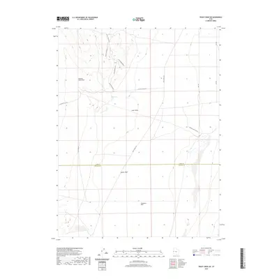
2020 Map of Trout Creek SW
USGS Topo · Published 2020About this map
Snake Valley serves as the dominant topographical feature of this Millard County landscape, where the high desert floor is etched by seasonal watercourses and drainage patterns. The mapping detail highlights a network of local thoroughfares including Valley Draw Rd and the multiple branches of Black Horse Road 3, Black Horse Road 5, and Black Horse Road 8. These routes navigate the varied elevations of Pleasant Valley Draw and connect to the historically significant path of the Pony Express Hwy.
Find a feature on this map
17 named features on this map. Tap any name to fly to it.
Don’t see what you’re looking for? This feature index may not catch every label — zoom into the map to look around manually.
Map Details
Editions of this 2020 Trout Creek SW Map
This is the sole edition of this map. No revisions or reprints were ever made.
Other maps of this area

1908 · Fish Springs
USGS Topo · 1:250,000

1910 · Fish Springs
USGS Topo · 1:250,000

1953 · Delta
USGS Topo · 1:250,000

1956 · Ely
USGS Topo · 1:250,000

1958 · Delta
USGS Topo · 1:250,000

1959 · Ely
USGS Topo · 1:250,000

1960 · Gandy
USGS Topo · 1:62,500

1961 · Trout Creek
USGS Topo · 1:62,500

1962 · Delta
USGS Topo · 1:250,000

1963 · Ely
USGS Topo · 1:250,000