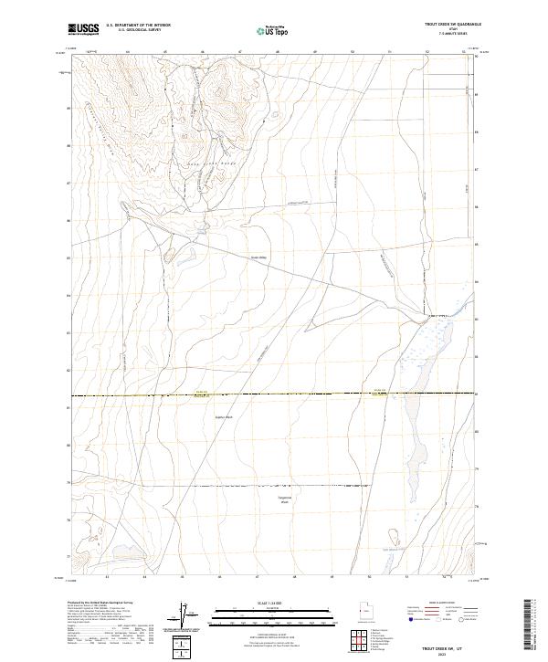
2023 Map of Trout Creek SW
USGS Topo · Published 2023About this map
Deep Creek Range rises as a prominent landmark in this arid portion of the Great Basin, where seasonal water sources and historical transit routes define the landscape. The iconic Pony Express Hwy cuts diagonally across the basin floor, tracing the same path used by riders over a century ago. This modern survey shows the intersection of these traditional trails with contemporary infrastructure like Pleasant Valley Rd and Partoun South Loop Rd. Hydrological features such as Salt Marsh Lake and Coyote Spring remain critical markers in the desert, while broad drainage systems like Sulphur Wash and Tungstonia Wash illustrate the complex natural irrigation of Snake Valley. The map also clearly delineates the administrative boundary between Juab Co and Millard Co.
Find a feature on this map
19 named features on this map. Tap any name to fly to it.
Don’t see what you’re looking for? This feature index may not catch every label — zoom into the map to look around manually.
Map Details
Editions of this 2023 Trout Creek SW Map
This is the sole edition of this map. No revisions or reprints were ever made.
Other maps of this area

1908 · Fish Springs
USGS Topo · 1:250,000

1910 · Fish Springs
USGS Topo · 1:250,000

1953 · Delta
USGS Topo · 1:250,000

1956 · Ely
USGS Topo · 1:250,000

1958 · Delta
USGS Topo · 1:250,000

1959 · Ely
USGS Topo · 1:250,000

1960 · Gandy
USGS Topo · 1:62,500

1961 · Trout Creek
USGS Topo · 1:62,500

1962 · Delta
USGS Topo · 1:250,000

1963 · Ely
USGS Topo · 1:250,000