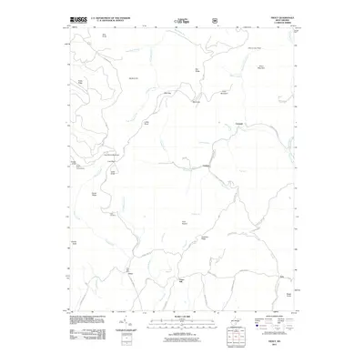
2011 Map of Trout
USGS Topo · Published 2011About this map
Trout and the Trout Post Office serve as a focal point for this rural Greenbrier County landscape, where the headwaters of Roaring Creek and Spring Creek carve through the high ridges of the Allegheny Mountains. The 2011 survey highlights a network of mountain roads like Sky Way and Richwood Rd connecting dispersed settlements such as Cordova and Friars Hill. Genealogists may find interest in the Reed Cemetery and landmarks like Luther's Knob, while the inclusion of sites like Glicks and Rock Camp suggests localized industry or traditional encampments. The terrain is defined by dramatic elevations, including Cold Knob Mountain and Grassy Knob, where a Lookout Tower stands as a sentinel over the surrounding forest. This map documents a region where life remains closely tied to the valleys and gaps of the Highland border.
Find a feature on this map
65 named features on this map. Tap any name to fly to it.
Don’t see what you’re looking for? This feature index may not catch every label — zoom into the map to look around manually.
Map Details
Editions of this 2011 Trout Map
This is the sole edition of this map. No revisions or reprints were ever made.
Other maps of this area

1887 · Hinton
USGS Topo · 1:125,000

1887 · Lewisburg
USGS Topo · 1:125,000

1889 · Nicholas
USGS Topo · 1:125,000

1891 · Lewisburg
USGS Topo · 1:125,000

1891 · Nicholas
USGS Topo · 1:125,000

1891 · Huntersville
USGS Topo · 1:125,000

1892 · Hinton
USGS Topo · 1:125,000

1894 · Huntersville
USGS Topo · 1:125,000

1901 · Nicholas
USGS Topo · 1:125,000

1918 · Richwood
USGS Topo · 1:62,500