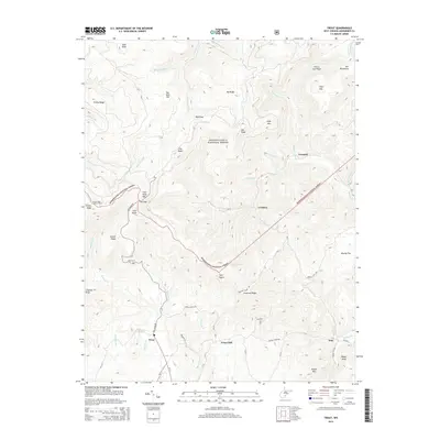
2014 Map of Trout
USGS Topo · Published 2014About this map
Monongahela National Forest dominates this section of the West Virginia highlands, where high ridges like the Yew Mountains and Pretty Ridge dictate the layout of small mountain communities. The settlement of Trout sits at the junction of Roaring Cr and Little Roaring Cr, while Cordova and Friars Hill anchor the local road network to the east. These small hamlets represent the enduring agricultural and timber-linked heritage of Greenbrier County. High-elevation landmarks such as the Grassy Knob Lookout Tower and Cold Knob Mtn overlook a complex drainage system of branches and runs, including Bumblebee Run and Beard Lick Run. Genealogists and local historians can locate specific sites like Reed Cem and family-named terrain such as Daniel Ridge, Boggs Knob, and Butler Mtn, which offer clues to early land use and settlement patterns in this part of the Appalachian plateau.
Find a feature on this map
74 named features on this map. Tap any name to fly to it.
Don’t see what you’re looking for? This feature index may not catch every label — zoom into the map to look around manually.
Map Details
Editions of this 2014 Trout Map
This is the sole edition of this map. No revisions or reprints were ever made.
Other maps of this area

1887 · Hinton
USGS Topo · 1:125,000

1887 · Lewisburg
USGS Topo · 1:125,000

1889 · Nicholas
USGS Topo · 1:125,000

1891 · Lewisburg
USGS Topo · 1:125,000

1891 · Nicholas
USGS Topo · 1:125,000

1891 · Huntersville
USGS Topo · 1:125,000

1892 · Hinton
USGS Topo · 1:125,000

1894 · Huntersville
USGS Topo · 1:125,000

1901 · Nicholas
USGS Topo · 1:125,000

1918 · Richwood
USGS Topo · 1:62,500