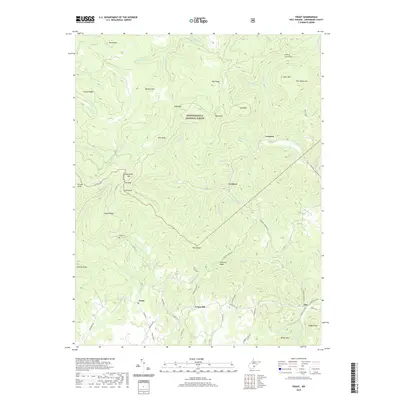
2019 Map of Trout
USGS Topo · Published 2019About this map
Monongahela National Forest dominates the upper reaches of this Greenbrier County terrain, where the high ridges of the Yew Mountains meet a series of prominent peaks and gaps. The landscape is defined by its verticality, rising from the valley floor at Trout and Friars Hill toward the heights of Cold Knob Mtn and Short Mtn. These small settlements are linked by winding routes like Leonard Cordova Rd and Richwood Rd, tracing the natural paths carved by drainage systems including Spring Cr and Roaring Cr. For local historians, the placement of the Reed Cem and various family-named features like Luther's Knob and Boggs Knob provide specific points of reference for tracing the early residency and land use patterns of this upland region.
Find a feature on this map
72 named features on this map. Tap any name to fly to it.
Don’t see what you’re looking for? This feature index may not catch every label — zoom into the map to look around manually.
Map Details
Editions of this 2019 Trout Map
This is the sole edition of this map. No revisions or reprints were ever made.
Other maps of this area

1887 · Hinton
USGS Topo · 1:125,000

1887 · Lewisburg
USGS Topo · 1:125,000

1889 · Nicholas
USGS Topo · 1:125,000

1891 · Lewisburg
USGS Topo · 1:125,000

1891 · Nicholas
USGS Topo · 1:125,000

1891 · Huntersville
USGS Topo · 1:125,000

1892 · Hinton
USGS Topo · 1:125,000

1894 · Huntersville
USGS Topo · 1:125,000

1901 · Nicholas
USGS Topo · 1:125,000

1918 · Richwood
USGS Topo · 1:62,500