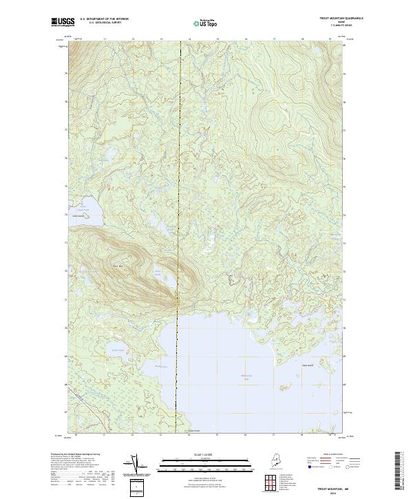
2024 Map of Trout Mountain
USGS Topo · Published 2024About this map
Katahdin Woods and Waters National Monument dominates the northeastern section of this Maine landscape, marking a protected wilderness where the Piscataquis and Penobscot county lines meet. The terrain is defined by its complex hydrography, notably the expansive northern reach of Millinocket Lake and numerous isolated water bodies like Bottle Pond, Oak Hill Pond, and the Logan Ponds. This modern survey reveals a network of logging and access routes essential to the region's history, including the Golden Rd and Tote Rd 16. The topography rises toward Trout Mtn, surrounded by a dense system of drainage including Sandy Stream, Togue Stream, and Mud Brook. Landmarks such as Clark Island and Powers Point delineate the irregular shoreline of the lake, providing a clear view of the area's contemporary geography and conservation boundaries.
Find a feature on this map
31 named features on this map. Tap any name to fly to it.
Don’t see what you’re looking for? This feature index may not catch every label — zoom into the map to look around manually.
Map Details
Editions of this 2024 Trout Mountain Map
This is the sole edition of this map. No revisions or reprints were ever made.
Other maps of this area

1927 · Katahdin
USGS Topo · 1:48,000

1930 · Katahdin
USGS Topo · 1:62,500

1949 · Katahdin
USGS Topo · 1:62,500

1951 · Norcross
USGS Topo · 1:62,500

1951 · Millinocket
USGS Topo · 1:62,500

1953 · Stacyville
USGS Topo · 1:62,500

1954 · Millinocket
USGS Topo · 1:250,000

1958 · Millinocket
USGS Topo · 1:250,000

1960 · Millinocket
USGS Topo · 1:250,000
1975 · Stacyville NW
USGS Topo · 1:24,000