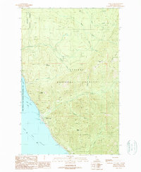
1989 Map of Trout Peak
USGS Topo · Published 1989About this map
The northeastern shores of Lake Pend Oreille meet the towering Selkirk and Cabinet mountain ranges in this late-twentieth-century survey. The settlement of Trestle Creek serves as a focal point along the shoreline, where the Pend Oreille State Wildlife Management Area protects the wetlands of the Pack River Flats. This landscape is defined by the steep elevation gains from the lake level at 2,062 feet up to prominent summits like Kirby Mountain, Grief Mountain, and Trout Peak.
Find a feature on this map
30 named features on this map. Tap any name to fly to it.
Don’t see what you’re looking for? This feature index may not catch every label — zoom into the map to look around manually.
Map Details
Editions of this 1989 Trout Peak Map
This is the sole edition of this map. No revisions or reprints were ever made.
Other maps of this area

1911 · Priest Lake
USGS Topo · 1:250,000

1913 · Priest Lake
USGS Topo · 1:250,000

1949 · Packsaddle Mtn
USGS Topo · 1:62,500

1951 · Packsaddle Mtn
USGS Topo · 1:62,500

1951 · Clark Fork
USGS Topo · 1:62,500

1951 · Mt Pend Oreille
USGS Topo · 1:62,500

1951 · Elmira
USGS Topo · 1:62,500

1958 · Sandpoint
USGS Topo · 1:250,000

1963 · Sandpoint
USGS Topo · 1:250,000
1984 · Sandpoint
USGS Topo · 1:100,000