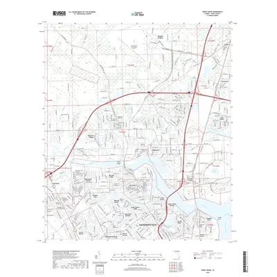
2018 Map of Trout River
USGS Topo · Published 2018About this map
The Trout River and its various tributaries, including Cedar Creek and Moncrief Creek, define the residential and industrial corridors of northern Jacksonville. This landscape is marked by a concentration of significant memorial sites and cemeteries, such as Restlawn Memorial Park, Greenwood Cem, and the Duval County Paupers Cem, providing a detailed record for genealogical research in neighborhoods like Royal Terrace and Magnolia Gardens. To the north, the massive infrastructure of Jacksonville International Airport stands in contrast to the winding wetlands of the Broward River and Little Cedar Creek. The map documents the established community footprints of Dinsmore, Oceanway, and Biscayne Village, showing how the urban grid interacts with the riverbanks leading toward the Saint Johns River at Sandfly Point.
Find a feature on this map
426 named features on this map. Tap any name to fly to it.
Don’t see what you’re looking for? This feature index may not catch every label — zoom into the map to look around manually.
Map Details
Editions of this 2018 Trout River Map
This is the sole edition of this map. No revisions or reprints were ever made.
Other maps of this area

1917 · Cambon
USGS Topo · 1:62,500

1917 · Hilliard
USGS Topo · 1:62,500

1918 · St Marys
USGS Topo · 1:62,500

1918 · Cambon
USGS Topo · 1:62,500

1918 · Jacksonville
USGS Topo · 1:62,500

1919 · St Marys
USGS Topo · 1:62,500

1919 · Hilliard
USGS Topo · 1:62,500

1948 · Jacksonville
USGS Topo · 1:250,000

1948 · Eastport
USGS Topo · 1:24,000

1950 · Arlington
USGS Topo · 1:24,000
Featured Places
- Jacksonville, FL
- Biscayne Village, Jacksonville
- Dinsmore, Jacksonville
- Lake Forest Hills, Jacksonville
- Ribault Manor, Jacksonville