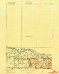
1918 Map of Troutdale
USGS Topo · Published 1918About this map
Columbia River riverfront life and early 20th-century transportation networks define this corner of Multnomah County. The map details the convergence of the Sandy River and the Columbia, a landscape dominated by river islands like Gary Island and Reed Island. The Willamette Base Line serves as a primary geographic anchor for the rural grid, where small settlements and schoolhouses like Buckley School and Cedar School supported a growing agricultural community.
Find a feature on this map
48 named features on this map. Tap any name to fly to it.
Don’t see what you’re looking for? This feature index may not catch every label — zoom into the map to look around manually.
Map Details
Editions of this 1918 Troutdale Map
2 editions found
Other maps of this area

1897 · Portland
USGS Topo · 1:62,500

1905 · Portland
USGS Topo · 1:62,500

1911 · Boring
USGS Topo · 1:48,000

1914 · Boring
USGS Topo · 1:62,500

1914 · Oregon City
USGS Topo · 1:62,500

1916 · Estacada
USGS Topo · 1:125,000

1918 · Troutdale
USGS Topo · 1:62,500

1934 · Troutdale
USGS Topo · 1:48,000

1939 · Oregon City
USGS Topo · 1:62,500

1940 · Lookout Mtn
USGS Topo · 1:62,500