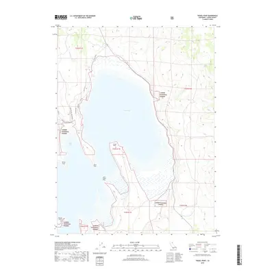
2018 Map of Troxel Point
USGS Topo · Published 2018About this map
Eagle Lake dominates this northern California landscape, its irregular shoreline defined by numerous volcanic and alluvial projections such as Troxel Point, Buck Point, and Little Troxel Point. Within the protected boundaries of the Lassen National Forest, the map reveals a small residential enclave at the northwestern corner of the lake, where a network of local roads like Stone Rd, Stoney Ln, and Juniper Ln serve local residents and visitors. The terrain rises sharply away from the water, particularly to the east toward Jauriga Spring, while the western shore is characterized by seasonal drainage patterns from Cleghorn Cr flowing into Buck Bay. This 2018 survey provides an exact record of the lake's modern footprint, documenting the extent of wetlands and the critical intersection of State Route 139 and Eagle Lake Rd.
Find a feature on this map
25 named features on this map. Tap any name to fly to it.
Don’t see what you’re looking for? This feature index may not catch every label — zoom into the map to look around manually.
Map Details
Editions of this 2018 Troxel Point Map
This is the sole edition of this map. No revisions or reprints were ever made.
Other maps of this area

1886 · Honey Lake
USGS Topo · 1:250,000

1891 · Honey Lake
USGS Topo · 1:250,000

1893 · Honey Lake
USGS Topo · 1:250,000

1954 · Grasshopper Valley
USGS Topo · 1:62,500

1954 · Fredonyer Peak
USGS Topo · 1:62,500

1955 · Westwood
USGS Topo · 1:250,000

1956 · Hayden Hill
USGS Topo · 1:62,500

1956 · Antelope Mtn
USGS Topo · 1:62,500

1958 · Westwood
USGS Topo · 1:250,000

1959 · Westwood
USGS Topo · 1:250,000