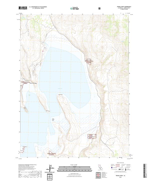
2022 Map of Troxel Point
USGS Topo · Published 2022About this map
Eagle Lake dominates this northern California landscape, framed by the protected boundaries of the Lassen National Forest. The small community of Stones Landing serves as a primary access point along the western shore, where residential streets like Stone Rd and Castlerock Rd meet the waterfront. The eastern and southern reaches of the lake are defined by a series of prominent peninsulas and bays, including Troxel Point, Buck Point, and Buck Bay.
Find a feature on this map
26 named features on this map. Tap any name to fly to it.
Don’t see what you’re looking for? This feature index may not catch every label — zoom into the map to look around manually.
Map Details
Editions of this 2022 Troxel Point Map
This is the sole edition of this map. No revisions or reprints were ever made.
Other maps of this area

1886 · Honey Lake
USGS Topo · 1:250,000

1891 · Honey Lake
USGS Topo · 1:250,000

1893 · Honey Lake
USGS Topo · 1:250,000

1954 · Grasshopper Valley
USGS Topo · 1:62,500

1954 · Fredonyer Peak
USGS Topo · 1:62,500

1955 · Westwood
USGS Topo · 1:250,000

1956 · Hayden Hill
USGS Topo · 1:62,500

1956 · Antelope Mtn
USGS Topo · 1:62,500

1958 · Westwood
USGS Topo · 1:250,000

1959 · Westwood
USGS Topo · 1:250,000