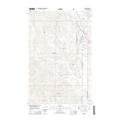
2014 Map of Troy
USGS Topo · Published 2014About this map
Troy centers this 2014 survey, situated where Callahan Cr meets the winding Kootenai River. The town's grid is well-defined, featuring streets such as E Mineral Ave and St Regis Haul Rd, reflecting its role as a local hub between the river and the Purcell Mountains. The surrounding landscape is dominated by the Kootenai National Forest, with significant peaks including Preacher Mtn and McConnell Mtn rising sharply from the river valley. The transportation network is anchored by Old US Hwy 2 S and the Troy Airport, while local history is marked at the Troy Cem. Numerous drainages like Threemile Cr and Iron Cr carve through the high terrain, which transitions from riverfront lowlands at Scott Island to the higher elevations of Copper Mtn.
Find a feature on this map
64 named features on this map. Tap any name to fly to it.
Don’t see what you’re looking for? This feature index may not catch every label — zoom into the map to look around manually.
Map Details
Editions of this 2014 Troy Map
This is the sole edition of this map. No revisions or reprints were ever made.
Other maps of this area

1911 · Priest Lake
USGS Topo · 1:250,000

1913 · Priest Lake
USGS Topo · 1:250,000

1920 · Libby
USGS Topo · 1:125,000

1930 · Libby
USGS Topo · 1:125,000

1932 · Libby
USGS Topo · 1:125,000

1951 · Mt Pend Oreille
USGS Topo · 1:62,500

1957 · Kalispell
USGS Topo · 1:250,000

1958 · Sandpoint
USGS Topo · 1:250,000

1960 · Kalispell
USGS Topo · 1:250,000

1961 · Kalispell
USGS Topo · 1:250,000